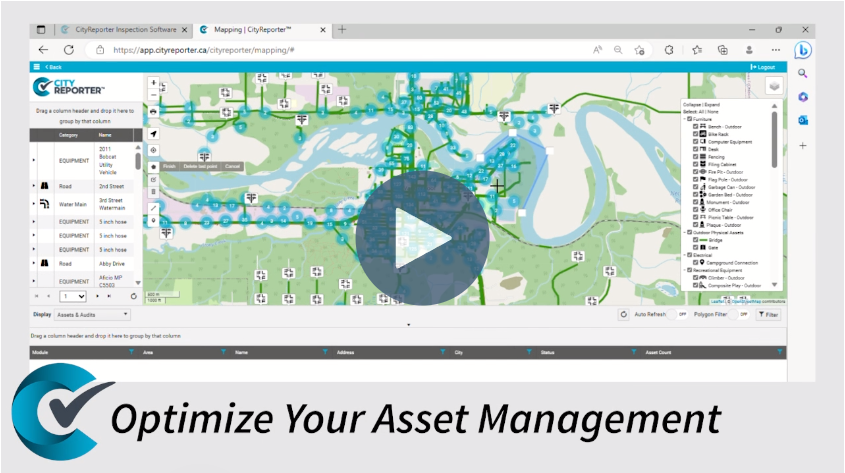
Experience the power of CityReporter’s cutting-edge mapping software, empowering crews to efficiently manage and monitor assets and locations with ease on an interactive map.

Watch Our Asset Mapping Video
Discover Visual Organization & Management
Simple to Set Up, Simple to Use
Efficiently Monitor & Manage Anything
CityReporter’s cutting-edge GIS mapping capabilities, encompassing advanced data visualization, real-time vehicle tracking, storm event monitoring, and a host of other innovative features, have completely transformed asset maintenance. Our software guarantees streamlined maintenance operations and enhanced safety measures for everyone involved without the need for you to have a dedicated GIS team.
Transform your workflow with our add-on feature, which allows you to effortlessly keep track of inspections, assets, locations, and much more, all through a seamless interactive map. Revolutionize team organization and management with our state-of-the-art integrated mapping tools.
Optimize Management & Maintenance
Pinpoint mobile, linear, and point assets with exact coordinates
Filter assets by type or group in a simple legend or by drawing a polygon directly on the map
Track weather event operations live and provide documented cycle analysis
Monitor live vehicle tracking in real-time or through a playback with detailed analytics such as speed, plow up/down, and more
Effective Live Tracking
View and manage vehicles and event with GIS
Harness the power of CityReporter’s mapping components to effortlessly monitor the whereabouts of your mobile assets such as devices and vehicles. Ensure that in the rare case they go missing in the field, you can swiftly locate them with ease.
Experience the cutting-edge live mapping process of CityReporter, providing you with real-time tracking of all your maintenance vehicles. From the direction of travel to speed, plow up/down, and other vital information, our comprehensive tracking features have got you covered.
Stay one step ahead during snow events and patrols by monitoring them in real time with our innovative color-coded mapping system. Effortlessly visualize travel patterns and track the completion of plowing and sanding, all while recording every critical data point for future reference and streamlined reporting.


